San Benito, Petén
This article needs additional citations for verification. (December 2009) |
San Benito | |
|---|---|
 | |
| Coordinates: 16°55′0″N 89°54′0″W / 16.91667°N 89.90000°W | |
| Country | |
| Department | |
| Government | |
| • Mayor | Sonia de Pleitez (LIDER) |
| Area | |
| • Total | 43 sq mi (112 km2) |
| Elevation | 449 ft (137 m) |
| Population (2012) | |
| • Total | 59,486 |
| • Density | 1,400/sq mi (530/km2) |
| Climate | Aw |
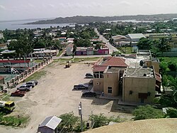
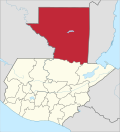
San Benito is a municipality in the El Petén department of Guatemala. It covers an area of 112 km2, and had 29,926 inhabitants at the 2002 Census; the latest official estimate (as at mid 2012) was 59,486 people.
It is located adjacent to departmental capital Flores.
Sports
[edit]Deportivo San Benito football club have been playing in the second tier of Guatemalan football since they clinched promotion from the third tier after the 1998/1999 season.[1] They play their home games in the Estadio Alejandro Ochaeta Requena. Deportivo Don Bosco football club have been playing in the third tier of Guatemalan football since 2015/2016 season.[2] They play their home games in the Estadio Alejandro Ochaeta Requena.
References
[edit]- ^ Guatemala 1998/99 - RSSSF
- ^ Guatemala 1998/99 - RSSSF
Missione Petèn (http://missionepeten.altervista.org)


